Iowa Counties SVG Map
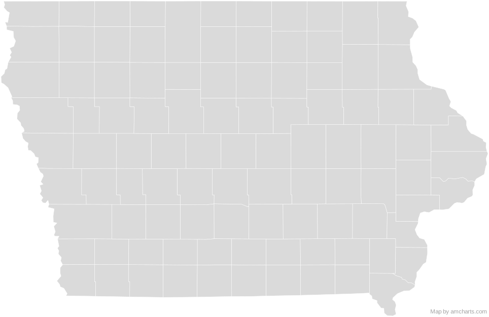
Free Iowa Counties SVG map with 99 counties, in Mercator projection, high and low detail.
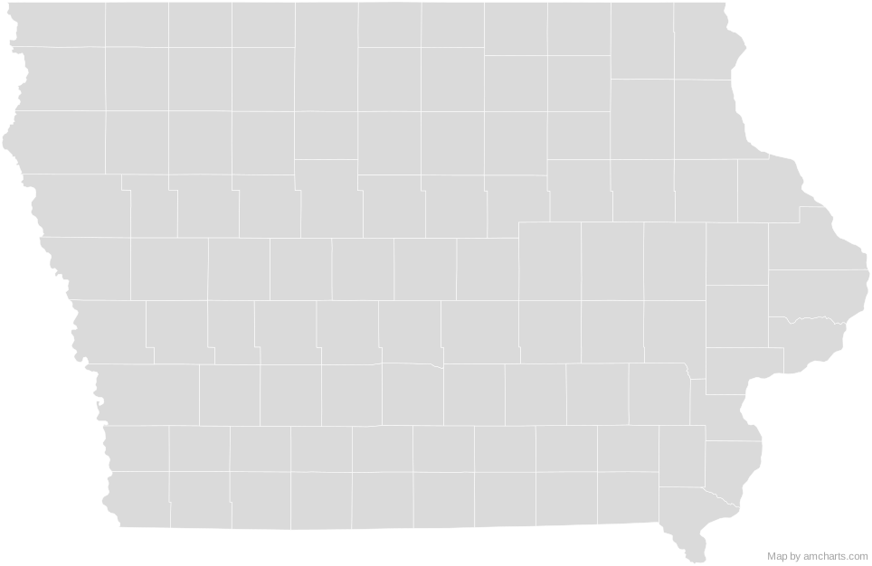
Free for any use, commercial projects included, as long as you keep the amCharts credit (CC BY 4.0).
All 427 maps, no credit needed: $99 Every SVG map in one ZIP, royalty-free, with updates.99 regions, named and coded.
- Adair
19001 - Adams
19003 - Allamakee
19005 - Appanoose
19007 - Audubon
19009 - Benton
19011 - Black Hawk
19013 - Boone
19015 - Bremer
19017 - Buchanan
19019 - Buena Vista
19021 - Butler
19023 - Calhoun
19025 - Carroll
19027 - Cass
19029 - Cedar
19031 - Cerro Gordo
19033 - Cherokee
19035 - Chickasaw
19037 - Clarke
19039 - Clay
19041 - Clayton
19043 - Clinton
19045 - Crawford
19047 - Dallas
19049 - Davis
19051 - Decatur
19053 - Delaware
19055 - Des Moines
19057 - Dickinson
19059 - Dubuque
19061 - Emmet
19063 - Fayette
19065 - Floyd
19067 - Franklin
19069 - Fremont
19071 - Greene
19073 - Grundy
19075 - Guthrie
19077 - Hamilton
19079 - Hancock
19081 - Hardin
19083 - Harrison
19085 - Henry
19087 - Howard
19089 - Humboldt
19091 - Ida
19093 - Iowa
19095 - Jackson
19097 - Jasper
19099 - Jefferson
19101 - Johnson
19103 - Jones
19105 - Keokuk
19107 - Kossuth
19109 - Lee
19111 - Linn
19113 - Louisa
19115 - Lucas
19117 - Lyon
19119 - Madison
19121 - Mahaska
19123 - Marion
19125 - Marshall
19127 - Mills
19129 - Mitchell
19131 - Monona
19133 - Monroe
19135 - Montgomery
19137 - Muscatine
19139 - O'Brien
19141 - Osceola
19143 - Page
19145 - Palo Alto
19147 - Plymouth
19149 - Pocahontas
19151 - Polk
19153 - Pottawattamie
19155 - Poweshiek
19157 - Ringgold
19159 - Sac
19161 - Scott
19163 - Shelby
19165 - Sioux
19167 - Story
19169 - Tama
19171 - Taylor
19173 - Union
19175 - Van Buren
19177 - Wapello
19179 - Warren
19181 - Washington
19183 - Wayne
19185 - Webster
19187 - Winnebago
19189 - Winneshiek
19191 - Woodbury
19193 - Worth
19195 - Wright
19197
No region matches that.
Need it interactive in your app?
The same map ships with the amCharts 5 library as am5geodata_region_usa_iaLow, ready for zoom, tooltips, heat maps and drill-downs. See JavaScript Maps.
import am5geodata from "@amcharts/amcharts5-geodata/region/usa/iaLow";

chart.series.push(
  am5map.MapPolygonSeries.new(root, {
    geoJSON: am5geodata
  })
);Around Iowa Counties
Can I use this map commercially?
Yes, for free, as long as you keep the amCharts credit (CC BY 4.0). To use maps without the credit, get the SVG Maps pack: all 427 maps for $99, one payment.
Which projection is it in?
Mercator, fitted to the map's own bounds. For Equal Earth, Albers, orthographic and others, use the SVG Map Generator.
How are the regions identified?
Each region is its own <path> with an id (the ISO code where one exists) and a data-name, so you can style or script it directly.
Will it open in Figma, Illustrator or Inkscape?
Yes. It is plain SVG: no scripts, fonts or external references.